Landslide risk modeling
Increasingly intense precipitation means that the risk of flood-induced landslides has risen. In recent years, we have had an increasing number of landslides. Flood-induced landslides consist of a combination of loose landmass and water. It is a mobile landslide, one that often starts as an erosion process in steep terrain. The volume of the landslide can increase dramatically on the way down the slope. This is a result of erosion and the entrainment of landmass. Landslides can move long distances and have a devastating impact on objects that appear in their path on their way down the slope. Klima 2050 is therefore developing tools that are better at predicting when flood-induced landslides will occur, how the landslide will progress, and at estimating the impact that they will have on the structures that they meet. This will allow tailor-made solutions to be developed that reduce the risk associated with potential landslides in vulnerable locations. The work carried out in Klima 2050 in this field includes both model testing in flood runs and advanced numerical modelling; results from the model trials will provide data necessary for numerical models in the future. Importantly, this work will be useful in connection with major infrastructure projects, such as the construction of a new ferry-free E39, which includes areas where landslides are a problem.
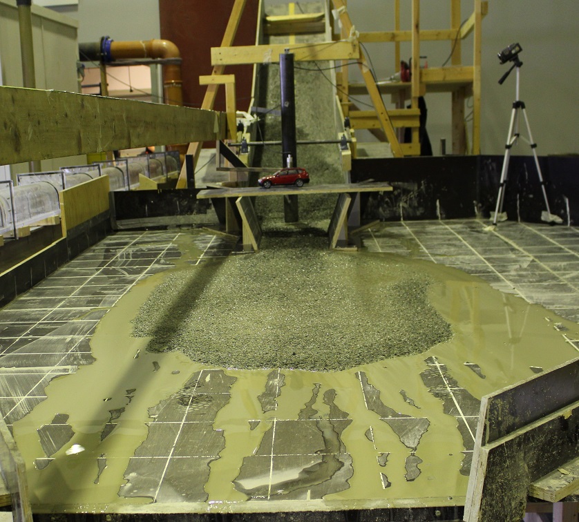
Model testing in flood runs. Photo: Ashenafi Yifru, NTNU